Module 8: Political Geography
Section outline
-
Political geography is the study of the ways in which humans have divided up the surface of the Earth for purposes of management and control. In the United States, many people think of this subdiscipline as being focused on memorizing the states, and state capitals, and perhaps learning the location of various countries around the world. These facts do show how politics is reflected on the surface of the Earth, but political geography is much more than a “trivial pursuit” of such information. (From Puyallup pdf 4.1)
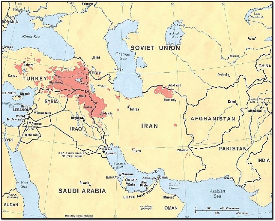
Figure 8.1: Stateless nation: Kurd-majority areas in Turkey, Syria, Iraq, and Iran, Author | U.S. Central Intelligence Agency, Source | Wikimedia Commons, License | Public Domain
Upon completion of this module, you will be able to:
- Explain: how political space is organized. (MLO 1)
- Explain: how states cooperate in military and economic alliances. (MLO 2)
- Describe: the various types of boundaries and how boundary disputes develop. (MLO 3)
- Link: the electoral process in the United States to ethnic, urban/rural, and regional affiliations. (MLO 4)
To achieve these objectives:
- Read the Module 8 Introduction
- Read and view the materials in the Module 8 Pressbooks book
- Read Chapter 8: Political Geography in Introduction to Human Geography.
- Complete the discussion questions,
Background Colour
Font Face
Font Kerning
Font Size
Image Visibility
Letter Spacing
Line Height
Link Highlight
Text Colour